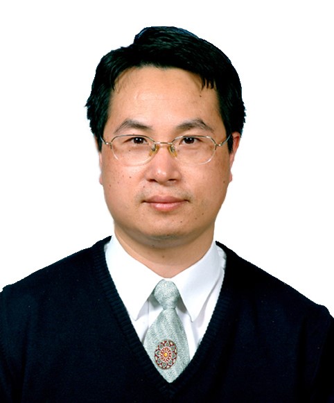
Dr Weicheng Wu graduated with a PhD in Environmental Geography from the University of Paris I (Pantheon-Sorbonne), France in 2003. He is actually professor and PhD supervisor at the East China University of Technology (ECUT). He is a member of the Chinese Geological Society and of the French Geographical Society. He serves as Guest Editor of several ISI-refereed journals such as "Remote Sensing" and "International Journal of Geo-Information". He was the Chair of the "International Conference on Geo-information Technology and its Applications (ICGITA 2019)" and is one of the Board Members and/or Technical Advisors of the Scientific Committees of various international conferences. He won the titles of "Ten Chinese Leading Talents on Science and Technology in Europe in 2018" and was supported by the Jiangxi Talent Program since 2018.
Dr. Wu has gained 33 years of professional experience, including 21 years of international career in application of geo-information technology in environmental monitoring, land resource evaluation and disaster early warning in European universities (France, Belgium and Italy) and international organization (ICARDA). He has been involved and partly led more than 20 international R&D projects funded by the European Commission, the European Space Agency (ESA) and the world consortia (AusAID, CGIAR, IFAD, UNDP, WFP, etc.). These projects were focused in Central, Southern and Western Asia, Eastern, Northern and Western Africa, and the European Mediterranean region. He provided technical support for food security analysis and sustainable use of natural resources in the developing countries, especially, in the war-torn countries such as Afghanistan, Iraq, Syria and Sudan. At the same time, his innovative R&D works have also broadened the scientific understanding of and contributed to the technological progress and innovation in the involved fields .
In the past 3 years, he has been undertaking 3 provincial/ministerial-level and university-level scientific research projects, and lectured on "Research Progress in Geography", "Remote Sensing Image Processing and Methods", "Application of Geographic Information Analysis and Remote Sensing Technology", "Environmental Resources and Sustainable Development" for postgraduate students. He supervises one PhD and 10 master students at ECUT.
Awards:
Research on “Innovative soil salinity mapping by remote sensing in Mesopotamia, Iraq” won the third prize of the "Jiangxi Provincial Natural Science Award" in 2019, as first author; and "Accurate and rapid regional land use mapping method" won the third prize of Jiangxi Remote Sensing Science and Technology Award, as first author.
Publications
Dr Wu has published more than 80 research papers with the known national and international journals such as Land Degradation and Development, Remote Sensing, and International Journal of Applied Earth Observation and Geoinformation, etc., and those of the recent 5 years are listed as follows:
Majid Nazeer, Muhammad Bilal, Janet Elizabeth Nichol, Weicheng Wu*, Mohammad M.M. Alsahli, Muhammad Imran Shahzad, and Bijoy Krishna Gayen, 2020. First Experiences with the Landsat-8 Aquatic Reflectance Product: Evaluation of the Regional and Ocean Color Algorithms in a Coastal Environment. Remote Sensing, 2020, 12(12), 1938 (https://doi.org/10.3390/rs12121938, June 2020) [IF: 4.509]
(2)Majid Nazeer, Muhammad Waqas, Muhammad Imran Shahzad, Ibrahim Zia and Weicheng Wu, 2020. Coastline Vulnerability Assessment through Landsat and Cubesats in a Coastal Mega City. Remote Sensing, 2020, 12(5), 749 (https://doi.org/10.3390/rs12050749, Feb 2020). [IF: 4.509]
Weicheng Wu, Ahmad S Muhaimeed, Waleed M Al-Shafie and Ayad MF Al-Quraishi, 2019. Using L-band radar data for soil salinity mapping—a case study in Central Iraq. Environmental Research Communications, 1: 081004 (https://doi.org/10.1088/2515-7620/ab37f0).
Weicheng Wu, Ahmad S. Muhaimeed, Waleed M. Al-Shafie, and Ayad M. Fadhil Al-Quraishi, 2019. Using Radar and Optical Data for Soil Salinity Modeling and Mapping in Central Iraq. In: A.M. Fadhil, A. Negm (Eds), Environmental Remote Sensing in Iraq, Springer, Chapter 2, p.19-40 (https://doi.org/10.1007/978-3-030-21344-2_2).
Weicheng Wu, 2019. A brief review on soil salinity mapping by optical and radar remote sensing. In: J.C. Dagar et al.(Eds.), Research Developments in Saline Agriculture, Springer, Chapter 2, p.53-65, (https://doi.org/10.1007/978-981-13-5832-6_2).
Ayad M. Fadhil Al-Quraishi, Sarchil H. Qader and Weicheng Wu, 2019. Drought Monitoring Using Spectral and Meteorological Based Indices Combination: A Case Study in Sulaimaniyah, Kurdistan Region of Iraq. A.M. Fadhil, A. Negm (Eds), Environmental Remote Sensing in Iraq, Springer Water, Chapter 15, p.372-393 (https://doi.org/10.1007/978-3-030-21344-2_15).
Weicheng Wu, Claudio Zucca, Ahmad S. Muhaimeed, Waleed M. Al-Shafie, Ayad M. Fadhil Al-Quraishi, Vinay Nangia, Minqiang Zhu and Guangping Liu, 2018. Soil salinity prediction and mapping by machine learning regression in Central Mesopotamia. Land Degradation & Development, 29(11): 4005-4014 (https://doi.org/10.1002/ldr.3148) (CiteScore: 4. 73)
Weicheng Wu, Claudio Zucca, Fadi Karam and Guangping Liu, 2016. Enhancing the performance of regional land cover mapping. International Journal of Earth Observation and Geoinformation, 52: 422-432 (DOI: 10.1016/j.jag.2016.07.014) (IF: 4.652)
(8)Claudio Zucca, Weicheng Wu, Leonarda Dessena and Maurizio Mulas, 2015: Assessing the effectiveness of land restoration interventions in drylands by multitemporal remote sensing – a case study in Ouled Dlim (Marrakech, Morocco). Land Degradation & Development, 26 (1): 80-91 (DOI: 10.1002/ldr.2307) (CiteScore: 4. 73)
Weicheng Wu, Waleed M. Al-Shafie, Ahmed S. Mhaimeed, Feras Ziadat, Vinay Nangia and William Payne, 2014: Soil salinity mapping by multiscale remote sensing in Mesopotamia, Iraq. IEEE Journal of Selected Topics in Applied Earth Observations and Remote Sensing, 7(11): 4442-4452 (DOI:10.1109/JSTARS.2014.2360411) (IF: 3.827)
Weicheng Wu, Ahmad S. Mhaimeed, Waleed M. Al-Shafie, Feras Ziadat, Vinay Nangia and Eddy De Pauw, 2014:Mapping soil salinity changes using remote sensing in Central Iraq, Geoderma Regional, 2-3: 21-31 (DOI: 10.1016/j.geodrs.2014.09.002). (IF: 2.667)
Weicheng Wu, 2014: The generalized difference vegetation index (GDVI) for dryland characterization. Remote Sensing, 6 (2): 1211-1233 (DOI:10.3390/rs6021211) (IF: 4.509)
Weicheng Wu, Eddy De Pauw and Claudio Zucca, 2013: Use remote sensing to assess impacts of land management policies in the Ordos rangelands in China. International Journal of Digital Earth, 6 (Supplement 2) : 81-102 (DOI: 10.1080/17538947.2013.825656) (IF: 3.097)
Weicheng Wu, Eddy De Pauw and Ulf Hellden, 2013: Assessing woody biomass in African tropical savannas by multiscale remote sensing. International Journal of Remote Sensing, 34(13): 4525–4549 (DOI: 10.1080/01431161.2013.777487) (IF: 2.976)
Impacts
(1) Position with national and international journals and social associations (position and start/end time)
Guest Editor of the ISI-refereed journals such as Remote Sensing, and International Journal of Geo-Information, 2019-2020;
Acting as reviewer for more than 20 top ISI-refereed journals in Remote Sensing, Geography and Environment,2004-present;
IEEE Member (2012-2014), Member of the French Society of Geography (2014-present), Chinese Geological Society (2018-present), Trustee of the International Association of Water, Environment, Energy and Society (IAWEES) (2018-present).
Participation in/Organization of International Conferences
In the past 2 decades, Di Wu has participated in or presided more than 35 international conferences or symposiums. Those in the recent 5 years are listed as follows:
Organization of International Conference:
International Conference of Geo-Information Technology and its Applications (ICGITA2019), Swiss Grand Hotel, Nanchang, China, Oct 11-13, 2019. Chairman: DrWeicheng Wu.
Attending Conferences
(1)Lifeng Xie, Weicheng Wu, Xiaolan Huang, Penghui Ou, Ziyu Lin, Yong Song, Zhiling Wang, Tao Lang, Wenchao Huangfu, Yang Zhang, Xiaoting Zhou, Xiao Fu, Jie Li, Jingheng Jiang, Ming Zhang, Zhenjiang Zhang, Yaozu Qin, Shanling Peng, and Chongjian Shao, 2020. Restoration monitoring of rare earth element (REE) mines in southern Jiangxi, China. EGU General Assembly 2020, Vienna, May 4-8, 2020 [Oral Presentation by Ms Lifeng Xie on the EGU 2020 Webconference]
(2)Xiaoting Zhou, Weicheng Wu, Ziyu Lin, Guiliang Zhang, Renxiang Chen, Yong Song, Zhiliang Wang, Tao Lang, Penghui Ou, Wenchao Huangfu, Yang Zhang, Lifeng Xie, Xiaolan Huang, Yaozu Qin, Shanling Peng, and Chongjian Shao, 2020. Landslide hazard risk mapping based on Random Forest Classification in Ruijin, Jiangxi, China. EGU General Assembly 2020, Vienna, May 4-8, 2020 [Oral presentation by Ms Xiaoting Zhou on EGU 2020 Webconference].
(3)Weicheng Wu, Yaozu Qin, Chongjian Shao, Shanling Peng, Wenheng Liu, Xiangtong Liu and Abdelrahim E. Jahelnabi, 2019. Simple novel approach for detecting fire hazards and burnt areas by remote sensing. The International Conference on Geo-Information Technology and its Applications (ICGITA 2019), Nanchang, China, Oct. 11-13, 2019. [Dr Weicheng Wu, Keynote Speaker].
(4)Weicheng Wu, Shanling Peng, Yaozu Qin, Lifeng Xie, Xiaolan Huang, Penghui Ou, 2019. Potential International Cooperation on Geospatial Technology under the Framework of the Road and Belt (R&B) Initiative. UNOOSA/CNSA Forum on Space Solutions, Changsha, China, April 24-26, 2019. [Dr Weicheng Wu, Keynote Speaker]
(4)Weicheng Wu, 2019. Soil salinity mapping by optical and radar remote sensing. Golden Jubilee International Salinity Conference, Feb 07-09, 2019, Karnal, India (Lead Keynote) [Dr Weicheng Wu, Lead Keynote Speaker]
(5) Weicheng Wu, Ahmad S. Mhaimeed, Waleed Al-Shafie, Ayad M. Fadhil, 2018. Application of ALOS L-band radar data in soil salinity modeling and mapping in Central Iraq. International Workshop On Climate Change and Soil Salinity Dynamics: Threats and Challenges, Apr.11-12, 2018, Manama, Bahrain [Dr Weicheng Wu, Keynote Speaker]
(6)Weicheng Wu, Eddy De Pauw, Claudio Zucca and Minqiang Zhu, 2018. Carbon emissions caused by woodland fires in the African tropical savannas. 5th International Conference on Water, Environment, Energy and Society (ICWEES 2018), May 08-11, 2018, Hotel Edan Star, Djerba-Zarsis, Tunisia [Dr Weicheng Wu, Oral Presenter]
(7)Weicheng Wu, Ayad M. Fadhill, Claudio Zucca, Ahmad S. Mhaimeed, Waleed Al-Shafie, 2016. Impacts of climate change on rangeland productivity in Western Asia. Presented in the United Nations Workshop on the Use of Space Technology for Dust Storm and Drought Monitoring in the Middle East Region. Nov 05-09, 2016, Tehran, Iran [Dr Weicheng Wu, Oral Presenter]
(8)Ahmad S. Mhaimeed, Weicheng Wu, Waleed M. AL-Shafie, Feras Ziadat, Hassan H. Al-Musawi, Kasim A. Saliem, 2013: Use Remote Sensing To Map Soil Salinity in the Musaib Area in Central Iraq. International Journal of Geosciences and Geomatics, pp.34-41 (ISSN: 2052-5591) [Dr Ahmad S. Mhaimeed, Oral Presenter]
(9)Weicheng Wu, Claudio Zucca, Leonarda Dessena and Maurizio Mulas. 2013. Using SPOT Imagery to Assess the Effectiveness of Combating Desertification in Marrakech, Morocco. The 2nd Int. Conf. on Agro-Geoinformatics 2013, Fairfax, USA. Aug 12-16, 2013 [Dr Weicheng Wu, Oral Presenter]
(10)Weicheng Wu, Waleed Al-Shafie, Ahmad Mhaimeed, Binan Dardar, Feras Ziadat and William Payne, 2013. Multiscale Salinity Mapping in Central and Southern Iraq by Remote Sensing. The 2nd Int. Conf. on Agro-Geoinformatics 2013, Fairfax, USA. Aug 12-16, 2013 [Dr Weicheng Wu, Oral Presenter]
(11)Weicheng Wu, Ahmad S. Mhaimeed, Waleed M. Al-Shafie, Ayad A. Hameed, Hassan H. Al-Musawi, Abdu Jabbar Khalaf, Kasim A. Salim, Feras Ziadat and Binan Dardar.2013: Multitemporal soil salinity mapping by remote sensing in the Dujaila area in Central Iraq. The International Conference on Agricultural Technologies in Arid Lands. Mar.19-21, 2013, Riyadh, Saudi Arabia [Dr Weicheng Wu, Oral Presenter]


