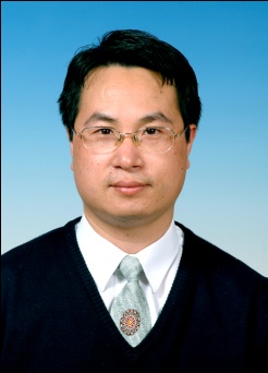
吴伟成(Weicheng Wu),巴黎第十一大学 (Univ Paris XI) 环境工程硕士 (1998) 和巴黎第一大学 (Univ Paris I)环境地理学博士 (2003),是东华理工大学数字化国土重点实验室教授,江西省 “双千计划“ 入围者和 “欧洲华人十大科技领军人才“入选者。
吴博士是国际环境地理学者、遥感专家,具有32年的工作经验。除了地球科学背景外 [地质工程学士 (1986)、硕士 (1995)及11年的地球科学方面的教学和科研工作(助教和讲师)],吴博士拥有21年在欧洲 [法国科研中心 (CNRS)的PRODIG实验室、巴黎高等研究实践学院 (EPHE)、比利时鲁汶大学 (Univ Louvain)、意大利萨萨里大学 (Univ Sassari)] 和 联合国与世界银行共管的国际干旱地区农业研究中心 (ICARDA, 国际机构) 从事地球空间信息技术 (Geospatial Technology) 在环境监测、资源评价及灾害识别和预警等领域应用的国际经历。
他参与并部分引领了20多项由法国科研中心、欧共体、欧洲空间局 (ESA) 和世界财团 (比如:AusAID, CGIAR, IFAD, UNDP, USAID等)支助的在环境动态监测及灾害评价、土地资源调查、碳吸收/排放分析等方面的国际合作研发项目。他的项目工作区遍布于中亚、西亚 、南亚(比如:阿富汗、伊拉克、叙利亚、黎巴嫩、约旦、土耳其、印度、巴基斯坦和孟加拉国等),西非、北非和热带非洲地区 (比如:毛里塔尼亚、摩洛哥、突尼斯、埃塞俄比亚、苏丹等),欧洲地中海 (意大利、葡萄牙、西班牙和希腊等)及中国西部地区。他的研发为世界上贫穷的发展中国家或地区的脱贫提供技术支持,为它们的可持续环境资源利用提供科学依据。
他已经发表了70余篇国际会议和期刊论文,是20多种在遥感、环境、土壤和地理领域的世界顶级SCI期刊的评审人和多个世界性学术讨论会的科学委员会成员。他是“国际水、环境、能源和社会联盟” (ICWEES)理事会成员和该联盟在中国办公室 (Country Office) 主任。2018年,作为高端人才引进,吴博士入职东华理工大学。
他的研究兴趣和方向:地球空间信息技术、环境灾害监测、土地资源(农林牧业资源)动态变化及粮食安全、土地使用引起的碳吸收和排放、气候变化对环境资源尤其对水资源的影响、“人-环” 相互作用和环境资源可持续利用分析等。
招生方向:
地质灾害(滑坡、泥石流等)风险识别和评价
核废处置库地质体稳定性评价
环境地理-人与环境相互作用
环境资源调查及其可持续利用分析
土地使用变化监测及其动因分析
多生物群区 (multi-biome) 生物量估算及土地使用有关的碳吸收/排放
局部和区域性农业估产
自然灾害(比如土地盐碱化、极端气候变化) 对农业资源和粮食安全影响
土地退化、沙漠化监测和分析
联系方式:
Email: wuwc030903@sina.com/Wuwch@ecit.cn
附:吴博士近5年的主要科研项目和发表成果:
项目
澳大利亚国际农业研究中心(ACIAR)支助的 “Integrated Salinity Management in Central and Southern Iraq”项目课题A “伊拉克区域性土地盐碱化调查” 负责人,2010-2014;总经费:Au$ 2.28 百万 (我支配经费: Au$26.4
)
欧共体-国际农业发展基金(EU-IFAD)支助的 “Integrated Wheat and Legume Cropping System” 项目(范围:叙利亚、约旦、黎巴嫩、埃及、苏丹、突尼斯、摩洛哥、阿尔及利亚等) 的 “北非突尼斯和摩洛哥小麦和豆科作物长势监测、估产和预警系统设计” 课题负责人,2013-2015; 总经费:US$ 2.25百万(我支配经费: US$11.5
)
国际农业研究协商组织(CGIAR) 支助的 “CRP3.5 Project on Better Targeting the Opportunity of Grain Legume” 项目框架下 “南亚豆科作物环境和土地适应性评价(包括印度、巴基斯坦、孟加拉国和斯里兰卡)” 课题负责人,2012-2017,总经费: US$ 4.529百万 (我支配的经费: US$ 30.2
)
澳大利亚国际农业研究中心 (ACIAR/AusAID) 支助的 ‘Integrated Catchment Management Project in Afghanistan”项目中 “Sayyad流域范围土地资源评价” 课题负责人,2012-2016,总经费: Au$ 5.375 百万 (我支配的经费:Au$22.6万)
东华理工大学2018年特聘高层次人才科研启动基金(编号:DHTP080001)“大数据空间信息技术在可持续环境资源利用中的应用(工作区域:中国、中亚、西亚和热带非洲)”,2018-2021,经费:¥150万。
2) 期刊论文
Weicheng Wu, Claudio Zucca, Ahmad S. Muhaimeed, Waleed M. Al-Shafie, Ayad M. Fadhil Al-Quraishi, Vinay Nangia, Minqiang Zhu and Guangping Liu, 2018. Soil salinity prediction and mapping by machine learning regression in Central Mesopotamia. Land Degradation & Development . Published online on Sept 05, 2018. https://onlinelibrary.wiley.com/doi/abs/10.1002/ldr.3148 [SCI IF: 7.270, 一区]
Weicheng Wu, Claudio Zucca, Fadi Karam and Guangping Liu, 2016. Enhancing the performance of regional land cover mapping. International Journal of Earth Observation and Geoinformation, Vol.52, p.422-432 (DOI: 10.1016/j.jag.2016.07.014). [SCI IF: 4.002, 二区]
Claudio Zucca, Weicheng Wu, Leonarda Dessena and Maurizio Mulas, 2015: Assessing the effectiveness of land restoration interventions in drylands by multitemporal remote sensing – a case study in Ouled Dlim (Marrakech, Morocco). Land Degradation & Development, Vol. 26 (1), p.80-91 (DOI: 10.1002/ldr.2307). [SCI IF: 7.270, 一区]
Weicheng Wu, Waleed M. Al-Shafie, Ahmed S. Mhaimeed, Feras Ziadat, Vinay Nangia and William Payne, 2014: Soil salinity mapping by multiscale remote sensing in Mesopotamia, Iraq. IEEE Journal of Selected Topics in Applied Earth Observations and Remote Sensing, vol.7, No 11, p.4442-4452 (DOI:10.1109/JSTARS.2014.2360411). [SCIE IF: 2.777, 二区]
Weicheng Wu, Ahmad S. Mhaimeed, Waleed M. Al-Shafie, Feras Ziadat, Vinay Nangia and Eddy De Pauw, 2014:Mapping soil salinity changes using remote sensing in Central Iraq, Geoderma Regional, Vol.2-3, p.21-31(DOI: 10.1016/j.geodrs.2014.09.002).
Weicheng Wu, 2014: The Generalized Difference Vegetation Index (GDVI) for dryland characterization. Remote Sensing, Vol. 6 (2), p.1211-1233 (DOI:10.3390/rs6021211). [SCIE IF: 3.406, 二区]
Weicheng Wu, Eddy De Pauw and Claudio Zucca, 2013: Use remote sensing to assess impacts of land management policies in the Ordos rangelands in China. International Journal of Digital Earth, Vol.6 (Supplement 2), p.81-102 (DOI: 10.1080/17538947.2013.825656). [SCIE IF: 2.746, 二区]
Weicheng Wu, Eddy De Pauw and Ulf Hellden, 2013: Assessing woody biomass in African tropical savannas by multiscale remote sensing. International Journal of Remote Sensing, Vol. 34(13), p.4525–4549 (DOI: 10.1080/01431161.2013.777487). [SCI IF:1.782, 三区]
3)专题书籍章节、国际会议论文和主旨演讲:
Weicheng Wu, Ahmad S. Muhaimeed, Waleed M. Al-Shafie, and Ayad M. Fadhil Al-Quraishi, 2018. Using Radar and Optical Data for Soil Salinity Modeling and Mapping in Central Iraq. In: A.M. Fadhil, A. Negm (Eds), Environmental Remote Sensing in Iraq, Springer (in press). 专题书籍章节
Weicheng Wu, Ahmad S. Mhaimeed, Waleed Al-Shafie, Ayad M. Fadhil, 2018. Application of ALOS L-band radar data in soil salinity modeling and mapping in Central Iraq. International Workshop On Climate Change and Soil Salinity Dynamics: Threats and Challenges, Apr.11-12, 2018, Manama, Bahrain, 受邀大会主旨演讲 (Keynote speech).
Weicheng Wu, Eddy De Pauw, Claudio Zucca and Minqiang Zhu, 2018. Carbon emissions caused by woodland fires in the African tropical savannas. 5th International Conference on Water, Environment, Energy and Society (ICWEES 2018), May 08-11, 2018, Hotel Edan Star, Djerba-Zarsis, Tunisia, 大会报告和数字化摘要.
Weicheng Wu, Ayad M. Fadhill, Claudio Zucca, Ahmad S. Mhaimeed, Waleed Al-Shafie, 2016. Impacts of climate change on rangeland productivity in Western Asia. Presented in the United Nations Workshop on the Use of Space Technology for Dust Storm and Drought Monitoring in the Middle East Region. Nov 05-09, 2016, Tehran, Iran,受邀大会报告.
Ahmad S. Mhaimeed, Weicheng Wu, Waleed M. AL-Shafie, Feras Ziadat, Hassan H. Al-Musawi, Kasim A. Saliem, 2013: Use Remote Sensing To Map Soil Salinity in the Musaib Area in Central Iraq. International Journal of Geosciences and Geomatics, pp.34-41 (ISSN: 2052-5591), 大会报告和论文集.
Weicheng Wu, Claudio Zucca, Leonarda Dessena and Maurizio Mulas. 2013. Using SPOT Imagery to Assess the Effectiveness of Combating Desertification in Marrakech, Morocco. Proceedings of the 2nd Int. Conf. on Agro-Geoinformatics 2013, Fairfax, USA. Aug 12-16, pp. 543-546 (DOI: 10.1109/Argo-Geoinformatics.2013.6621980), 大会报告和论文集.
Weicheng Wu, Waleed Al-Shafie, Ahmad Mhaimeed, Binan Dardar, Feras Ziadat and William Payne, 2013. Multiscale Salinity Mapping in Central and Southern Iraq by Remote Sensing. Proceedings of the 2nd Int. Conf. on Agro-Geoinformatics 2013, Fairfax, USA. Aug 12-16, pp.470-475 (DOI: 10.1109/Argo-Geoinformatics.2013.6621965). 大会报告和论文集.
Boubaker Dhehibi, Roberto Telleria, Aden Aw-Hassan, Saad Hatem Mohamed, Feras Ziadat and Weicheng Wu, 2013. Economic Impacts of Salinity on Livelihoods: The case of Al-Musayyeb in Iraq. In: N. Lamaddalena, M. Todorovic, L.S. Pereira (Eds.),Proceedings of the Conference on Water, Environment and Agriculture: Challenges for Sustainable Development, pp.200-201, Sep 10-14, 2013, Bari, Italy, 大会报告和论文集.
Weicheng Wu, Ahmad S. Mhaimeed, Waleed M. Al-Shafie, Ayad A. Hameed, Hassan H. Al-Musawi, Abdu Jabbar Khalaf, Kasim A. Salim, Feras Ziadat and Binan Dardar.2013: Multitemporal soil salinity mapping by remote sensing in the Dujaila area in Central Iraq. Presented in the International Conference on Agricultural Technologies in Arid Lands. Mar.19-21, 2013, Riyadh, Saudi Arabia, 大会报告和论文集.


